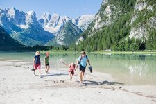
This hiking tour through the enchanting Valle d’Altafossa is ideal for families with children
Image gallery: Hike in the Valle d’Altafossa and to Lake Campolago
Starting point of our hike today is the parking space at the entrance of the Valle d'Altafossa at 1,606 m a.s.l. At the crossing in the village centre we turn left and follow the road until the sign of the parking space. A hint in advance: don't forget change for the ticket machine! Along a wide forest path we hike into the valley and follow first the marker to the Grossberghütte tavern, at a bifurcation we choose the left path and walk lightly uphill through the forest.
Soon we reach the first stop for a break, the Grossberghütte hut (1,638 m) with a gorgeous sun terrace. We carry on along the Valle d'Altafossa circular trail, the green meadows are covered with colourful alpine flowers. The Rio di Campolago meanders idyllically through this beautiful valley and offers children plenty of space to play on its waterfront. After about 1.5 hours we reach the lovely head of the valley and the Pranterstadelhütte and Wieserhütte mountain huts. Both are ideal stops to take a rest and offer nice arranged playgrounds.
For capable hikers it is a must-do to carry on to Lake Campolago. Behind the Pranterstadelhütte mountain hut we follow the path n° 15 towards Lake Campolago, only one more hour of walking to reach our destination. The path is very well-kept, but it becomes a bit steeper. The alpenroses are in full bloom, so we are surrounded by a pink sea of flowers. Looking back we (nearly) have a bird's eye view of the Valle d'Altafossa. After a demanding hour we reach a saddle where we catch sight of the behind located Big Campolago Lake (2,275 m), a place to stay.
Those who still want to carry on can climb further up to Mt Cima di Campolago at 2,724 m. The descent to the Valle d'Altafossa is done along the same route. Alternative route: near of the Wieserhütte mountain hut the path n° 16B branches off, it leads to the bifurcation near the parking space.
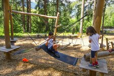
Please note: the Valle d'Altafossa is a fantastic excursion destination for families. The entire route until the mountain huts is also suitable for buggies. At the head of the valley an inviting playground with possibilities to climb and plenty of space to play and to let off steam awaits you.
Author: BS
-
- Starting point:
- Valle d'Altafossa parking space, Maranza
-
- Time required:
- 04:40 h
-
- Track length:
- 14,0 km
-
- Altitude:
- from 1.595 m to 2.275 m
-
- Altitude difference:
- +680 m | -680 m
-
- Route:
- parking space - Grossberghütte - Wieserhütte - Pranterstadelhütte - Lake Campolago - Pranterstadelhütte - Wieserhütte - Grossberghütte - parking space
-
- Signposts:
- 15, Rundweg Altfasstal (alternative for the way back 16B, 16A)
-
- Destination:
- Lake Campolago
-
- Resting points:
- Wieserhütte, Pranterstadelhütte
-
- Recommended time of year:
- Jan Feb Mar Apr May Jun Jul Aug Sep Oct Nov Dec
-
- Download GPX track:
- Hike in the Valle d’Altafossa and to Lake Campolago
If you want to do this hike, we suggest you to check the weather and trail conditions in advance and on site before setting out.


