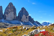
An alpine pasture hike with fantastic view, which leads to a rustic mountain hut
Image gallery: From Anterselva di Mezzo to the Kumpflalm hut
Starting point of our today's hike is Anterselva di Mezzo (Antholz Mittertal, in German). On the northern edge of the village, at the sports zone, several hiking paths start. We follow the signpost no. 12 towards the Kumpflalm mountain hut.
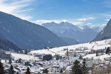
First we reach the Egger Waterfall, which can be discovered from close up in a 15-minute walk along a specially created path. Then a forest path follows and we quickly gain altitude. A stunning view on the village and large parts of the Anterselva Valley accompanies us.
Through meadows and forests, the path leads us steadily uphill, and ripe wild strawberries by the wayside invite us to take a short welcome rest again and again. Shortly before our destination, the Alta Via Alterselva (Mittertaler Höhenweg) branches off to the right, but we stay on path no. 12. After a good hour’s walk, we reach the Malga Kumpflalm, where we enjoy a deserved break. To come back to Anterselva di Mezzo we take the same path.
Author: AD
-
- Starting point:
- Anterselva di Mezzo
-
- Overall time:
- 02:00 h
-
- Total route length:
- 5,0 km
-
- Altitude:
- from 1.260 m to 1.655 m
-
- Altitude difference (uphill | downhill):
- +395 m | -395 m
-
- Signposts:
- 12
-
- Destination:
- Kumpflalm mountain hut
-
- Resting points:
- Kumpflalm mountain hut
-
- Recommended time of year:
- Jan Feb Mar Apr May Jun Jul Aug Sep Oct Nov Dec
-
- Download GPX track:
- From Anterselva di Mezzo to the Kumpflalm hut
If you want to undertake this hike, we recommend you to check the weather and trail conditions in advance and on site before setting out.


